Conservation efforts around the globe are getting a high-tech boost—literally. Satellites orbiting Earth are now being used to monitor wildlife, track habitats, and prevent poaching, offering a new lifeline to endangered species. By combining remote sensing, AI, and satellite imagery, scientists are gaining unprecedented insights into ecosystems that were previously impossible to observe.
How Satellites Help Wildlife
- Tracking Animal Movements
- GPS-enabled collars and tags communicate with satellites to monitor migration patterns and habitat use.
- Helps scientists identify critical feeding, breeding, and nesting areas.
- Detecting Habitat Loss
- High-resolution satellite imagery can reveal deforestation, urban expansion, and natural disasters that threaten ecosystems.
- Enables timely interventions to protect key habitats.
- Anti-Poaching Efforts
- Satellites can monitor illegal activities in protected areas, providing real-time alerts to rangers.
- AI algorithms detect suspicious patterns, helping prevent wildlife crimes before they occur.
- Climate Change Monitoring
- Satellites track temperature, precipitation, and vegetation changes affecting species survival.
- Scientists can model future habitat suitability under changing climate conditions.
Advantages of Satellite Conservation
- Global Coverage: Remote regions and oceans are now accessible for monitoring.
- Continuous Observation: Satellites provide constant data collection, unlike periodic field surveys.
- Non-Invasive: Monitors wildlife without disturbing natural behavior.
- Data Integration: Combines with drones, sensors, and AI for comprehensive ecosystem analysis.
Real-World Success Stories
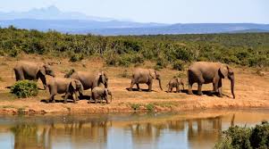
- Elephant Conservation: Satellites track elephant herds in Africa to prevent poaching along migratory routes.
- Penguin Population Studies: Imagery from space allows scientists to estimate penguin colony sizes in Antarctica.
- Forest Protection: Deforestation monitoring in the Amazon enables rapid response to illegal logging.
- Marine Conservation: Satellites detect changes in ocean temperatures and plankton blooms critical to marine food chains.
Challenges
- Data Processing: Massive volumes of satellite data require advanced AI and analytics to interpret.
- Funding and Accessibility: High-resolution satellite imagery can be expensive for small conservation groups.
- Ground Verification: Satellite data must often be validated with on-the-ground observations.
- Technical Limitations: Cloud cover, sensor resolution, and orbital constraints can affect data quality.
The Future of Satellite Conservation
- AI-Driven Predictions: Advanced algorithms could predict species population trends and habitat changes before they happen.
- Global Collaboration: Shared satellite data among governments, NGOs, and research institutions enhances conservation strategies.
- Integration with IoT: Sensors on the ground combined with satellites could provide real-time alerts for endangered species.
- Space-Based Biodiversity Monitoring: Continuous, high-resolution monitoring could revolutionize conservation science.
The Bottom Line
Satellites are not just tools for weather forecasting or communication—they are vital allies in the fight to save endangered species. By tracking wildlife, monitoring habitats, and preventing poaching, space technology is helping humanity protect biodiversity and preserve ecosystems for future generations.